One Last Walk in Switzerland
It’s our final day in Switzerland. Tomorrow we will be breaking camp and heading North, back into France, towards home. We had planned to take the awning down tonight, but the forecast tells us it’ll be dry overnight, which means there’s a greater chance of packing it away dry in the morning (always preferable). So it stays up, for now. Since we put it up, we’ve been experiencing an issue with the awning’s inflatable poles. One of them has flatly refused to stay up and had to be pumped up on a daily basis. I may be able to fix it when we get home, with a puncture repair kit, but the awning is starting to show its age. Investment in a replacement may be on the cards (and they’re not cheap).
I also want to give a big shout-out for the door locks in the campsite loos, which close with a very satisfying click. Unlike the generally poor plastic things you’ll find in most UK campsite loos, this is – to my mind – is a display of Swiss engineering at its finest.
For our final day in Switzerland I planned a walk from Lauterbrunnen of about 5 miles, which preferably needed to be neither too strenuous nor too challenging. I’ve signed-up for a free trial of the Komoot Premium app, in order to put it through it’s paces and see what extra functionality is available for £59 per year. As far as I can tell the only thing of particular use is it’s navigation and live-tracking function, so we’ll see.

For a Saturday, the town seemed far quieter than we’d expected (Friday was very busy). As we left the main street and started climbing the hill, it soon became apparent that the route I’d planned might be a little tougher than I first thought. The first half of the walk was all up, and Tracey and I spent much of it debating the precise definition of what constitutes an easy walk. In my defence the gradients weren’t too bad but they were definitely protracted at times, and it was a relief to finally get to the top. Along the way we were treated to some spectacular views across the valley, and realised at one point that we had actually climbed higher than Wengen.


Maybe I should take more notice of contour lines.
At the route’s highest point we found ourselves just below the snow line. The temperature dropped quite considerably and it started snowing on and off. We stopped to eat lunch on a bench placed right at the top of a sheer precipice, where we were treated to some great views, but it was cold. Fortunately it was all downhill from that point.
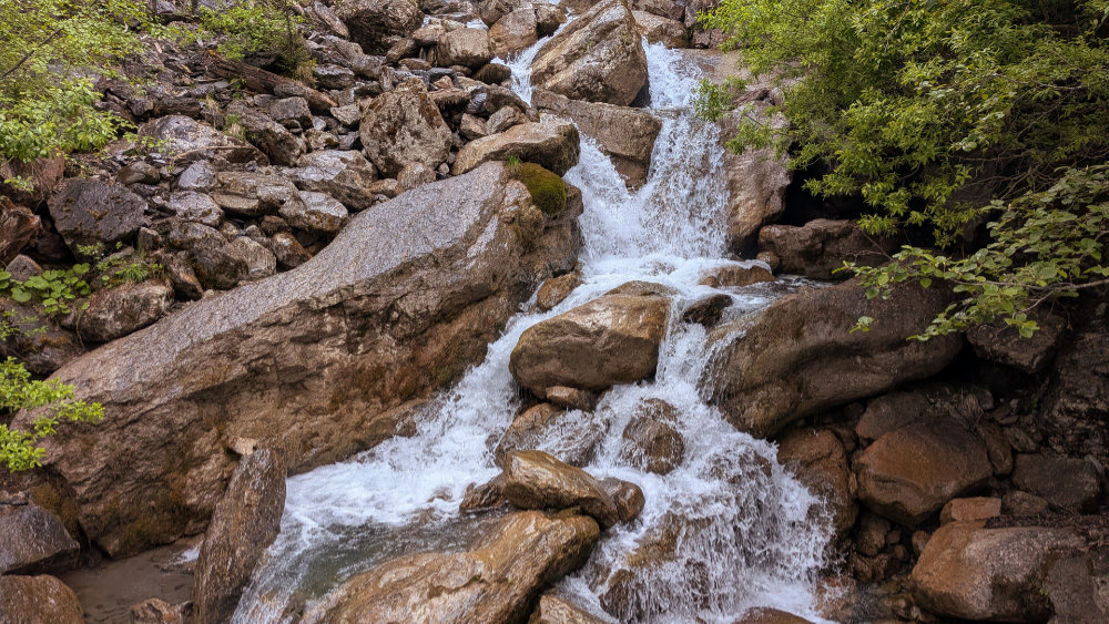
On our descent, we paused several times to admire a couple of impressive waterfalls on the Sousbach River, and were delighted to find our route also included a stretch through a wooded section, along a real natural footpath, similar to what we’re more used to back home.

We were both tired by the time we got back to Lauterbrunnen, and very much looking forward to relaxing with a cup of tea… but there was one final bit of business that needed attending to. Something we’d been promising ourselves all week. It’s a thing that we’d seen all visitors do… climb to the back of Staubbach waterfall…

Fortunately the wind wasn’t blowing the water away to the side, so we were right behind the fall. It was a tough climb with tired legs, and very wet, but satisfying nonetheless.

Tomorrow, we’ll be heading back up North.