Mountain Hiking in Andalsnes
Having spent a relaxing, and peaceful night in Andalsnes (no rocking and rolling), no engine sounds… lovely), we awoke with a plan that had been hatched ever since we knew we would be returning here; eat breakfast, don thermals and heavy-duty hiking gear, and go climb a mountain.

The base of the mountain in question was a short, 10 minutes walk away from the ship. Andalsnes itself is described in some quarters as the ‘Alpine Region of Norway’, and gazing around at the towering snowy peaks, it’s easy to see why.
Our climb was a repeat of one we did three years ago, when we first came here on the Marco Polo. It starts out quite easy, with well-places ramps and handrails to assist visitors as they steadily gain height. A small wooden shelter marks the first notable viewpoint, overlooking the small town of Andalsnes and with extensive views down the fjord.
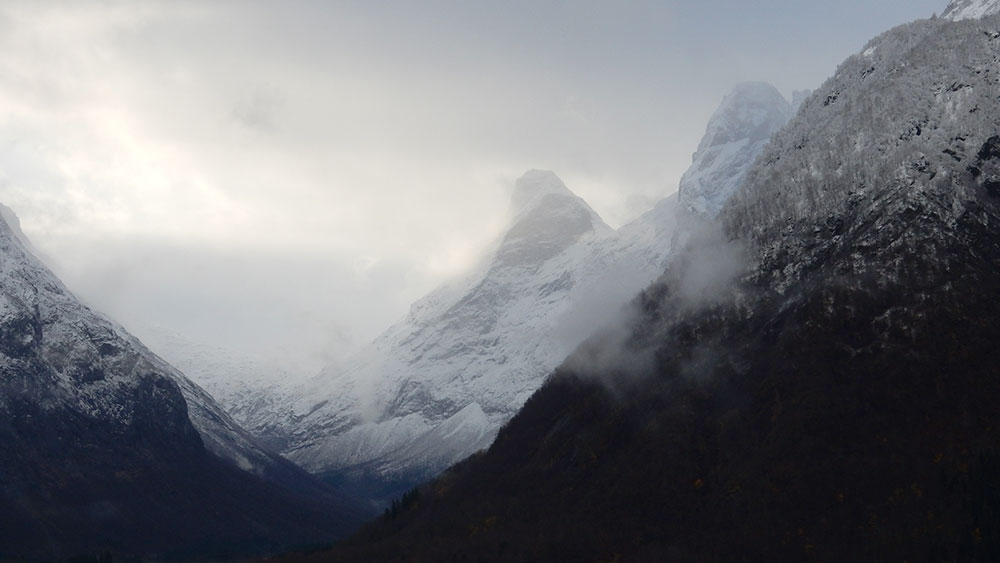
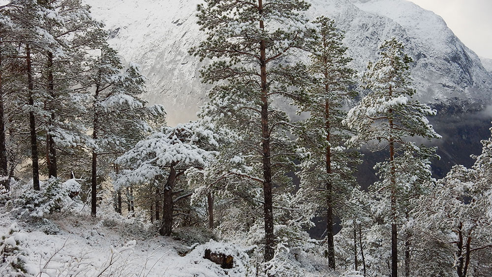
From here on, the going gradually gets steeper, and the handrails become less frequent. An abundance of tangled tree roots provide plenty of footholds, but they’re also slippy in places, threatening to trip the unwary hiker. Forty-five minutes or so later, we reached the snowline. At this point, the scene turned into a dazzling winter wonderland for a while before the trees themselves start thinning out. The views also became more impressive.

Our main objective was to reach a viewing platform that we knew about. It sticks out of the mountainside, and provides great views in all directions; it’s also a teensy bit scary; Tracey refuses to go to the very end because you can see right through to the trees far below.
We climbed a little further beyond the viewing platform, and a little higher, then stopped. With our main objective achieved, the plan was simply to retrace our steps, and head back down the hill. It was about 2pm at this point, and we had to be back on board by 4:45. We’d brought emergency chocolate with us but no water, relying on snow and a well-placed natural spring to keep ourselves from dehydrating (I should say that this was not part of the plan – the truth is, we simply forgot to put any water in the rucksack… again…).


We were just 170 metres or so short of the summit, and I was curious to see how things looked a little higher. Tracey wasn’t so keen; this was as far as we got the last time, and we’d turned around at this point because the trail becomes more exposed and a bit of a scramble. I decided to climb a little further; Tracey would wait for me… we agreed on just 10 minutes… On reflection, I wasn’t entirely sure what that actually meant; did this mean 10 minutes further walking, then 10 minutes back? Or 10 minutes total, which would mean 5 minutes walking, then 5 back…
I passed a couple on their way down, and asked if they’d been to the top. They told me they had, and that it had taken them about 30 minutes from the viewing platform. They warned me that the going got a little tough, but when they saw that I had spikes on my boots, they figured it wouldn’t be too much of a problem for me. This spurred me on… maybe just a little higher… it couldn’t hurt…

15 or 20 minutes later, way past the the agreed time, and way past a couple of false summits (just a little bit further…), I reached the top. Sure enough, the trail was very exposed in places, and the snow was much deeper. It was reasonably well waymarked, though, with a reassuring red ‘T’ appearing at convenient intervals, painted onto rocks. My main worry, as I plodded on, though, was the weather closing in on me and then not being able to find my way back. That can happen often in the hills; what at first can seem like a straightforward route can soon become confusing and difficult to follow.
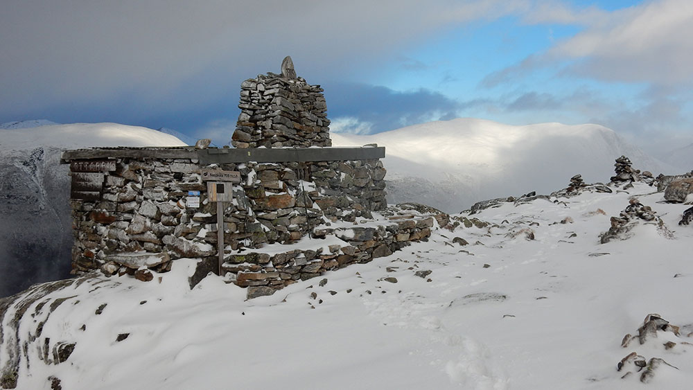
In truth, it wasn’t the absolute top; that would have taken me another 15 minutes or so, but I was satisfied that I had reached high enough, happy to have reached the stone shelter and cairn that signified the roof of the world. I took a few photographs of the views and the ridgeline stretching away from me to even greater peaks, and made a quick phone call to Tracey, to tell here that I was on my way back.
Together again, our descent was much harder going than the climb. For starters, you use different muscles to go downhill, and the tangled tree roots were difficult to navigate, with the threat of a hard landing never far away. In short, the return journey felt much longer, and by the time we reached the wooden shelter, and the top of the ramps, we were flagging. It was a relief to finally get back to the ship, get out of our wet clothes and take the boots off (Oooh! My feet were tender…).
Tired but satisfied, we spent the rest of the afternoon and evening chilling out.
An announcement from the Captain warned us of impending rough weather; with winds of up to 40 miles and hour and swells of up to 7 metres, the going was probably going to be uncomfortable. The window in our cabin has been covered over (which was a surprise because we didn’t know the window had deadlights), and passengers have been advised not to use the lifts…
It’s going to be an interesting night’s sailing…

